 California Water News Daily Your Source For Water News in California

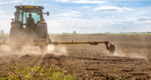
Certain areas of the San Joaquin Valley are continuing to sink rapidly according to new NASA radar satellite maps prepared for the California Department of Water Resources (DWR). Groundwater pumping and subsistence are continuing to put state and federal flood control structures and aqueducts at risk of damage.
The report released earlier this week shows that two main subsidence bowls, covering hundreds of square miles, grew wider and deeper between spring 2015 and fall 2016. Subsidence also intensified at a third area, near Tranquillity in Fresno County, where the land surface has settled up to 20 inches in an area that extends seven miles.
“The rates of San Joaquin Valley subsidence documented since 2014 by NASA are troubling and unsustainable,” said DWR Acting Director William Croyle. “Subsidence has long plagued certain regions of California. But the current rates jeopardize infrastructure serving millions of people. Groundwater pumping now puts at risk the very system that brings water to the San Joaquin Valley. The situation is untenable.”
A prior August 2015 NASA report prepared for DWR documented record rates of subsidence in the San Joaquin Valley, particularly near Chowchilla and Corcoran, as farmers pumped groundwater in the midst of California’s five-plus- year historic drought. However, in light of NASA’s new maps and discoveries, and as part of an ongoing effort to respond to the effects of California’s historic drought, state officials said they will investigate any legal options available to protect the state’s infrastructure. DWR will also investigate various measures for reducing subsidence risk to infrastructure including: possible groundwater pumping curtailment; creation of groundwater management zones near critical infrastructure; and, county ordinance requirements.
Additionally, DWR is conducting its own study of the effects of subsidence along the 444-mile-long California Aqueduct and other State Water Project features in order to identify potential actions to remediate damage in the coming months.
Restoring the full California Aqueduct to its original design capacity would likely cost in the hundreds of millions of dollars. A focused triage to address conveyance losses and comprehensive rehabilitation in the most affected portions of the canal may cost tens of millions of dollars per location.
Additional aircraft-based NASA radar mapping focused on the California Aqueduct, the main artery of the State Water Project, shows that subsidence caused by groundwater pumping near Avenal in Kings County has caused the Aqueduct to drop more than two feet. The drop has limited the Aqueduct to carrying a flow of 20 percent less than its design capacity of 8,350 cfs — only 6,650 cubic feet per second (cfs) – as project operators must reduce flows to avoid overtopping the concrete banks of the Aqueduct in those sections that have sunk due to subsidence. The California Aqueduct supplies some 25 million Californians and nearly 1 million acres of farmland.
DWR, which operates the State Water Project, is also analyzing whether the subsidence-created dip in the Aqueduct will affect deliveries to Kern County and Southern California water districts. If the State Water Project allocation is 85 percent or greater, delivery may be diminished this year due to the cumulative impacts of subsidence in the Avenal-Kettleman City area.
Also of concern is NASA’s finding of subsidence of up to 22 inches along the Delta-Mendota Canal, a major artery of the Central Valley Project (CVP), operated by the U.S. Bureau of Reclamation. The CVP supplies water to approximately three million acres of farmland and more than two million Californians.
NASA has also found an area of subsidence in the Eastside Bypass, a system designed to carry flood flow off the San Joaquin River in Fresno County. The Bypass runs through where the land surface has fallen between 16 inches and 20 inches since May 2015 – on top of several feet of subsidence measured between 2008 and 2012. DWR is working with local water districts to analyze whether surface deformation may interfere with flood-fighting efforts, particularly as this year’s heavy Sierra snowpack melts in the spring. DWR estimates that it may cost in the range of $250 million to acquire flowage easements and levee improvements to restore the design capacity of the subsided area.
Additionally, there are thousands of groundwater wells near state infrastructure that could be contributing to the subsidence recorded by NASA.
DWR will work with local water managers to identify specific actions to reduce long-term subsidence risk and consider whether to incorporate further emphasis on reduction of subsidence risk into the ongoing implementation of the Sustainable Groundwater Management Act (SGMA), the historic package of laws enacted by Gov. Jerry Brown in September 2014. Amongst its many elements, the SGMA requires groundwater-dependent regions to halt overdraft and bring basins into sustainable levels of pumping and recharge by the early 2040s.
To read NASA’s latest report, “Subsidence in California, March 2015-September 2016” go to: http://www.water.ca.gov/waterconditions/docs/2017/JPL%20subsidence%20report%20final%20for%20public%20dec%202016.pdf.