 California Water News Daily Your Source For Water News in California

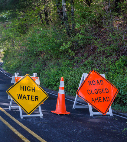
In the wake of flooding on Coyote Creek last February, the Santa Clara Valley Water District (SCVWD) Board of directors has authorized staff to proceed with two short-term proposals to reduce flood risks along the creek in San José’s Rock Springs neighborhood. An earthen berm of up to five feet tall and a vinyl sheet pile wall of up to three feet, to be completed by approximately end of December, are designed to prevent the intrusion of water and future flooding along Coyote Creek.
Coyote Creek is a natural channel and any physical alternations to the creek could potentially redirect flood threats downstream. To prevent creating risks in other areas, and after a variety of evaluations including a hydraulic analysis, staff carefully studied options for establishing barriers along vulnerable areas. Their analysis also included evaluating various options to reduce flood risks in other neighborhoods.
SCVWD is also now working with the city of San José for access to eliminate non-native vegetation along Coyote Creek on city-owned property. This work could include removal of 15 acres of invasive vegetation along the creek to benefit the area’s ecological habitat and improve the creek’s capacity for carrying stormwater. The property includes two parks – Selma Olinder and Watson – as well as nearby mobile home communities. The two agencies are also partnering to remove almost 4 acres of thickets of the thick, invasive Arundo donax reed which can significantly diminish a creek’s capacity.
In June, the SCWD Board authorized modifications to Coyote Creek Flood Protection Project, extending it by 2.9 miles upstream as per the voter-approved Safe, Clean Water and Natural Flood Protection Program. The project now includes vulnerable areas that were impacted in the last winter’s flooding. The board also revised the target level of flood protection from the previous 100-year flood to approximately a 20-25-year storm or the equivalent of the Feb. 21 floods. This equates to a one-in-four-year to one-in-five-year chance of the magnitude of last February’s deluge.
“We have been working diligently these past few months to get measures in place before the rainy season to help protect these communities,” said SCVWD Board Chair John Varela. “We witnessed the adverse effects from an extraordinarily wet winter and we are committed to reducing flood risks to help protect homes and businesses.”
The Coyote Creek modifications enable SCVWD to use local funding to reduce flood risks on Santa Clara County’s longest creek and the region’s main waterway in its largest watershed. SCVWD’s board is also seeking state and federal funding for a 100-year flood protection project in order remove land from FEMA-designated flood zones.
The board also recently hosted key leaders from the U.S. Army Corps of Engineers at the Rock Springs Playground which had been submerged in approximately two-feet of water during February’s flooding. SCVWD is working with the Corps on a Memorandum of Agreement for a feasibility study to reduce flood risks in the area.