 California Water News Daily Your Source For Water News in California

California’s Department of Water Resources (DWR) will soon be able to map the state’s groundwater basins from the air.
Using airborne electromagnetic (AEM) surveys, DWR will gather information about the state’s groundwater aquifer structure to better understand groundwater resources and support future drought response.
“The data collected during these surveys will provide a better understanding of California’s groundwater systems, and in turn support more informed and sustainable groundwater management and drought preparedness and response approaches,” said Steven Springhorn, DWR’s SGMA Technical Assistance Manager.
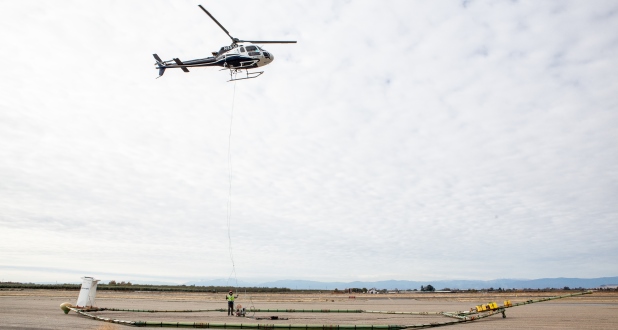
DWR will begin surveys this month in Salinas Valley, Paso Robles and Cuyama Valley. Several passes over the survey areas will be made by a low-flying helicopter towing a large hoop with scientific equipment approximately 100 feet above the ground surface. The helicopter may be visible to residents.
Surveys will be conducted over the next several years in high- and medium-priority groundwater basins.