 California Water News Daily Your Source For Water News in California

A new water year began in California last Saturday on the heels of the state’s fifth consecutive year of drought conditions. The most recent year was marked by “meager precipitation that fell more often as rain than snow” according to the California Department of Water Resources (DWR) and its recently released Drought and Water Year 2016: Hot and Dry Conditions Continue, a water year wrap-up delivered with detailed historical content.
Water Year 2016 is officially listed in the record books as ‘Dry’ statewide. Although parts of Northern California experienced average to slightly above average precipitation southern California continue to bake in warmer than average temperatures with little rain.
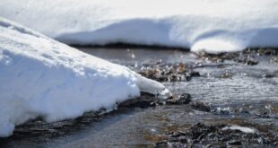
An early and below-average snow runoff, caused by record warm temperatures, was in large part absorbed by parched soil before ever reaching California’s reservoirs. The water content of the California Sierra snowpack — often referred to as ‘the State’s largest reservoir’ – is designed to flow into a series of above ground storage reservoirs each spring that essentially serve as the state’s water savings accounts in order to meet the growing demands of an uncertain climate future. But the state’s all-too-familiar dry, warming conditions have led State water officials to describe the situation as a California ‘snow drought.’
A ‘water year,’ a 12-month time period during which precipitation totals are measured, runs from October 1 to September 30 of the following year. The year is designated by the calendar year in which it ends.
Forecasters are unsure of what comes next. The forecast for Water Year 2017 is uncertain.
The National Oceanic and Atmospheric Administration’s Climate Prediction Center currently sees slightly better than even odds that weak La Niña conditions will develop this fall and winter. La Niña refers to the periodic cooling of sea-surface temperatures across the east-central equatorial Pacific. It represents the cold phase of the El Niño/Southern Oscillation cycle, nature’s year-to-year variations in oceanic and atmospheric conditions. La Niña is the opposite phase of the warm, El Niño phase that California experienced this water year. There are no guarantees for substantial La Niña rainfall for the 2017 rain year.
According to the DWR, historical records are the only source of facts to study for any indication of what California may see in the form of precipitation in coming months. Of the 18 La Niña winters since 1950-51, 16 have provided below average precipitation for Southern California’s coastal region, and 15 winters have resulted in below average precipitation for Southern California’s interior region. Above average precipitation was recorded in 11 winters for the Northern Sierra and in eight years for the Central and Southern Sierra. Water year 2011 brought the only significantly wet La Niña event in this time period.
Water officials warn that making seasonal forecasts of precipitation – the ability to predict now if 2017 will be wet or dry (and how wet or dry) – is scientifically difficult, and the accuracy of such predictions is very low; much less than that of a seven-day weather forecast. Currently, sixty percent of the state remains in severe or extreme drought.
Making water conservation a California way of life remains a statewide goal and a top priority in Governor Edmund G. Brown Jr.’s State Water Action Plan. Mandatory water restrictions today vary throughout California.