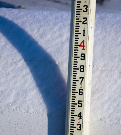
With the Sierra Nevada snowpack standing at 185 percent of normal conditions for the first day of March and a snow water equivalent (SWE) reading of 159 percent of the multi-decade March 1 average, Californians have something to celebrate after five-plus years of punishing drought conditions.
Frank Gehrke, chief of the California Cooperative Snow Surveys Program, spoke of the manual measurement at the Phillips snow course, near the intersection of Highway 50 and Sierra-at-Tahoe Road and said of his findings, “It’s not the record, the record being 56.4 (inches), but still a pretty phenomenal snowpack…. January and February came in with some really quite phenomenal atmospheric river storms, many of which were cold enough to really boost the snowpack.”
The manual measurements done at the Phillips snow course and other locations throughout the state augment the electronic readings from about 100 sensors in the state’s mountains that provide a continual current snapshot of the water content in the snowpack. SWE is theoretically the depth of water that would result if the entire snowpack melted instantaneously. That measurement is more important than the snow depth in evaluating the status of the snowpack. On average, the snowpack supplies about 30 percent of California’s water needs as it melts in the spring and early summer.
As of March 1’s measurements, the snowpack holds 45.5 inches of SWE or 185 percent of the March 1 average (24.6 inches). On January 1, before a series of storms, the SWE of the statewide snowpack was 6.5 inches, just 64 percent of the New Year’s Day average. On February 1, the statewide SWE was 30.5 inches, 174 percent of average for that date.
Also of note is status of not only the northern Sierra snowpack which now 39.2 inches or 159 percent of its normal average, but the status of the central and southern Sierra water content totals. The central Sierra’s snowpack stands at 49 inches or 191 percent of its average and the southern Sierra boasts 46.4 inches or a whopping 201 percent of its multi-decade average.
Gehrke indicated that central and southern regions in the Sierra Nevada are tracking close to 1983, which had the maximum recorded snowpack statewide. “Most of the snow courses are well over their April 1 accumulations, which at (Phillips) is 25 inches,” Gehrke said, “so we’ve busted through April 1 values pretty much at all snow courses throughout the state.”
Gehrke noted that in 1983, “It basically started snowing on Veterans Day and basically didn’t stop until Memorial Day. If we get another series of storms, we may end up record-setting on April 1. We’ll just have to see.”
 California Water News Daily Your Source For Water News in California


