Although Southern Californians awakened Monday morning to damp streets and wet vegetation meteorologists and radio stations were quick to say the moisture wouldn’t make a dent in California’s drought impacts in the southland. Luckily the precipitation news from Northern California was significantly better.
A soaking weekend storm front that moved through northern California provided much-needed rain in the lower elevations and snow in the mountains. Measurable rain was welcomed Friday through Sunday in Sacramento producing 0.59, 0.16 and 1.43 inches, respectively. Sunday’s nearly 1.5 inches broke the Oct. 16, 1984 best of 0.69 inches.
Rain measured by Marin Municipal Water District at Lake Lagunitas on Friday was 2.67 inches. According to the National Weather Service totals for other sites in the Marin area included: Mount Tamalpais, 3.61 inches; Kentfield, 2.52; Olema, 2.17; Marin Headlands 1.85 inches; and, 1.78 inches at Point Reyes Station.
At the higher elevations, snow provided some welcome relief to ski resorts looking to open in the coming weeks. The recent storm dropped seven to 18 inches of white powder at Mount Rose Ski Resort near Reno. The resort, at 8,260 feet, plans to open its ski runs on Oct. 31.
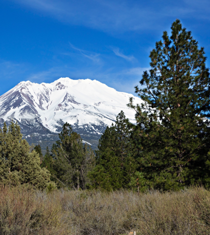
The storm also dumped some two inches of snow at Donner Summit. Travis Wilson, meteorologist with the National Weather Service said an inch of snow was measured in both Carson Pass and Ebbetts Pass. It was still snowing late in the day on Monday in the North State, including both Mt. Shasta and Lassen Volcanic National Park. A park guide at Lassen Park estimated about two inches has fallen at the south side visitors center.
But, precipitation notwithstanding, Marin Municipal Water District Spokesman Lon Peterson wisely cautioned, “Whether it’s raining or a drought, the new normal is conservation. We still want to be cautious.”
Peterson’s words reiterated cautious predictions from the National Oceanic and Atmospheric Administration (NOAA). NOAA’s scientists predicted in April a 71 percent chance of drier-than-normal La Niña conditions by November; by June they were predicting a 75 percent likelihood. The most recent NOAA forecast, issued last week, is a 70 percent possibility for La Niña conditions this fall.
But looking across the entire winter, NOAA research scientist and blogger Emily Becker said, “…any La Niña that develops is likely to be weak, and forecasters aren’t quite as confident that La Niña conditions will persist long enough to be considered a full-blown episode, giving it a 55 percent chance through the winter.”
 California Water News Daily Your Source For Water News in California


