 California Water News Daily Your Source For Water News in California

The Department of Water Resources (DWR) announced its groundwater mapping project was completed last week. The Statewide Airborne Electromagnetic (AEM) Survey Project surveyed 95 groundwater basins across California between December 2021 and November 2023.
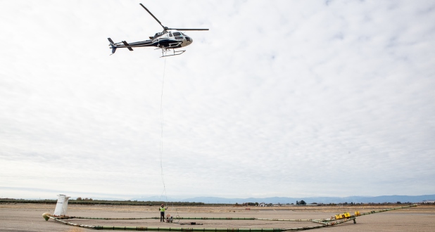
Using state-of-the-art helicopter-based technology to scan the earth’s subsurface to depths of up to 1,000 feet, DWR collected nearly 16,000 miles of AEM data. This data, which is now publicly accessible, is invaluable for identifying the most suitable locations to implement groundwater recharge projects that can capture water from winter rain and runoff events to store underground for use during dry periods.
“AEM data helps GSAs move more expediently towards development of projects in areas previously deemed as non-suitable for groundwater recharge,” said Kassy Chauhan, Executive Officer, North Kings Groundwater Sustainability Agency. “AEM has helped to navigate below ground to find the small pockets where the soil conditions are prime for groundwater recharge to occur. The picture of the sub-surface geology helps with project siting and ensures available financial resources are going towards feasible projects which will help get water into the underground helping the North Kings GSA reach its sustainability goals.”
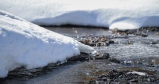
California’s high- and medium-priority groundwater basins provide a major source of water supply for more than 15 million people, especially during dry years when surface water supplies are lacking. As California adapts to a hotter, drier future, groundwater supplies are becoming a more vital resource for communities, households, businesses, agriculture, and the environment that all depend on this critical water source.
“The State continues to make investments in the latest technology, like AEM, to ensure we are prepared for the weather extremes that are playing out in the new climate reality,” said Paul Gosselin, Deputy Director of Sustainable Groundwater Management. “Data from these initial statewide AEM surveys are already being used by local groundwater agencies, and we are excited to move into the next phase, expanding data collection efforts and providing new tools for understanding and managing California’s groundwater on a local, regional, and statewide level.”
DWR is now moving into the next phase of this work, called Basin Characterization, where new and existing information, including AEM data, will be used to help identify and better understand underground aquifer structures and conditions more clearly.
DWR is expected to release the next Semi-Annual Groundwater Conditions Update in May, which will contain the most current statewide groundwater data and information, including Annual Report data submitted by local groundwater sustainability agencies.