After five seasons of punishing drought Californians can celebrate the 2016-17 water year – and keep conserving the state’s precious resource.
“California’s cities and farms can expect good water supplies this summer,” said DWR Acting Director Bill Croyle. “But this ample snowpack should not wash away memories of the intense drought of 2012-2016. California’s precipitation is the most variable in the nation, and we cannot afford to stop conserving water.”
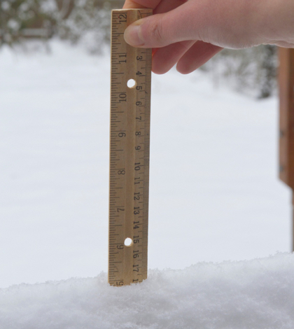
The May 1 manual snow survey at Phillips Station in the Sierra Nevada by the Department of Water Resources (DWR) – the last manual snow survey of the 2016-17 year – measured a Snow Water Equivalent (SWE) of 27.8 inches, 190 percent of the May 1 long-term average (14.6 inches). In comparison, most recent previous manual measurement showed a snow water equivalent of 46.1 inches or 183 percent of the historical average. The reduced SWE is to be expected considering the warming weather and the start of the annual spring melt and runoff. The first of April is normally when snowpack water content is at its peak.
Electronic measures throughout the Sierra Nevada are the primary, on-going measurement of water content of the statewide snowpack. The May 1 statistics indicate 42.5 inches or 196 percent of the May 1 average. Other statistics for the three primary areas are:
- Northern Sierra SWE is 39.9 inches (199 percent of average)
- Central Sierra SWE is 47.1 inches (202 percent of average), and the
- Southern Sierra SWE reading is 7.6 inches (180 percent of average.)
The SWE is regarded as the more important measurement versus snow depth when evaluating the status of the snowpack. SWE is the depth of water that would supposedly result if the entire snowpack melted instantaneously.
Frank Gehrke, chief of the California Cooperative Snow Surveys Program, conducted DWR’s survey today at Phillips and said of his findings, 2017 has been “an extremely good year in terms of the snowpack.”
Gehrke said the snowpack is encouraging in terms of surface water supplies. “The thing we’re looking out for is primarily the southern Sierra, where we have full reservoirs and in some cases a huge snowpack,” he said. “We want to make sure that we prudently manage that so we don’t cause any downstream issues.”
Nonetheless, officials are expecting some minor flooding along the Merced River in Yosemite National Park this weekend due to warming temperatures. The federal government’s California Nevada River Forecast Center’s website indicates that the Merced River could exceed its flood stage of 10 feet with a possible maximum stage of 11.3 feet and a flow of 8330 cfs (cubic feet per second) at Yosemite’s Pohono Bridge. Officials are not concerned with this potential flooding but will monitor the situation.
Measurements for the state’s largest reservoirs are topping the charts in comparison to the past five water years. Shasta Lake north of Redding, the federal Central Valley Project’s largest reservoir with a capacity of 4.5 million acre-feet, is at 109 percent of average or 94 percent of capacity. Lake Oroville in Butte County, the State Water Project’s (SWP) principal reservoir, is 91 percent of average for the date or 74 percent of its 3.5-million acre-feet capacity.
Water sports enthusiasts have been warned to exercise caution when swimming, boating, fishing and even passing through waterways and flooded areas on foot or on bicycles. Fast-running bodies of water and sudden surges in water flow can create sudden and significant changes affecting all water sports and activities.
 California Water News Daily Your Source For Water News in California


