 California Water News Daily Your Source For Water News in California

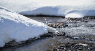
The Western United States has increasing been subject to the whims of Mother Nature regarding the availability of water supplies. Managing in an era of multi-year droughts, deluges and floods, and the need to protect and replenish dwindling groundwater basins is a challenge for any water manager.
Last year President Trump issued a Presidential Memorandum on Promoting the Reliable Supply and Delivery of Water in the West to aid water manager in knowing where, when, and how much precipitation will occur in a certain area. The memo directed the U.S. Department of Commerce (DOC) and the U.S. Department of the Interior (DOI) to develop an action plan, in coordination with water experts and resource managers, to improve forecasts of water availability. The Federal Action Plan for Improving Forecasts of Water Availability (Action Plan) has now been released.
“The Administration is committed to advancing America’s water infrastructure, and ensuring communities have reliable access to water,” said Mary B. Neumayr, Chairman of the Council on Environmental Quality. “The Action Plan is an important step toward improving our Nation’s observation, modeling and forecasting capabilities related to water availability, enabling the Federal government and stakeholders to make more timely and informed decisions.”
Although the Action Plan has just been released, 12 activities in the Action Plan have already been completed or are underway. One example is the National Oceanic and Atmospheric Administration’s (NOAA) new global forecast model, the foundation for all its weather forecast models. This change provides better numerical weather prediction into the future, including improved water prediction.
Another innovation is NOAA’s operational version 2.0 of the National Water Model. Using data from more than 8,000 U.S. Geological Survey (USGS) gauges, the new water model simulates and forecasts how water moves throughout the nation’s rivers and streams for over 5 million miles of rivers and streams in the contiguous United States. The model generates hourly forecasts for the entire river network as well as high-resolution forecasts of soil moisture, surface runoff, snow water equivalent, and other parameters.
Bureau of Reclamation and NOAA are also working with the National Center for Atmospheric Research to improve short-term forecasting to improve in-season reservoir operations for irrigation. Forecast Informed Reservoir Operations (FIRO) uses data from the watershed and weather and water for five-day forecasts to help water managers selectively retain or release water from reservoirs to balance operating priorities such as water supply, environmental flows, flood control, and dam safety. FIRO is being tested at California’s Lake Mendocino facility which is owned and operated by the U.S. Army Corps of Engineers.
Dr. Marty Ralph, director at the Center for Western Weather and Water Extremes, Scripps Institution of Oceanography at the University of California San Diego, spoke about FIRO and its application to potentially aid water storage and flood control liability at the 13th Annual 2019 San Bernardino County Water Conference in August. He shared with conference attendees that the FIRO concept was in use with Prado Dam in Riverside County and the Orange County Water District.
The Action Plan identifies four areas for improvement: enhance weather forecasts to improve water prediction; improve and expand the use of water forecast information to benefit water management outcomes; improve science and technology for water prediction; and implement integrated water availability assessments at national and local basin scales.
“The National Oceanic and Atmospheric Administration (NOAA) has met early milestones in the new federal action plan thanks to the landmark Weather Research and Forecasting Innovation Act and progress will continue to be made to improve water prediction forecasts through partnered activities leveraging the National Water Center,” said RDML Tim Gallaudet, Ph.D., USN Ret., deputy NOAA administrator. “Over the next three years, we will enhance our modeling tools for connecting accurate precipitation forecasts into surface water availability forecasts.”
Although many activities to improve water forecasts are already underway, goals set in the Action Plan extend through 2023. The USGS’s Next Generation Water Observation System will improve access to data that can be used in state-of-the-art forecasting and modeling tools to help improve decision-making by water managers. The USGS will release the National Water Census at the end of calendar year 2019, which will provide daily national assessments of water availability, initially only in terms of quantity but inclusive of quality and use by the end of 2020.